Thursday, June 20, 2013

Western Canadian Rockies (WCR) – Day 11 – Back to Vancouver

Our last travel day and final destination for the tour is Vancouver and we should get there by 4:00 this afternoon.  It is still raining, but we hear that the weather should clear by tomorrow.  As we go through some of the passes, we go by several platforms for the avalanche canon emplacements.  In the winter, a canon on the platform is used to fire on the snow to force an avalanche so no one gets hurt.


Between the rain, low light and water on the windows, we take very few pictures today.  As you can see, the clouds and fog are denser then yesterday.

As we near the town of Hope, we cross the Coquihalla pass and another avalanche "tunnel" for the roadway.  This one is a little longer than others we have go into the past yesterday.


Along the way, with the amount of rain we have had, the rivers are swelling and there are a number of waterfalls coming off of the steep mountain faces.


We had our farewell dinner tonight.  We have made such good friends, it is sad to say goodbye.

Everyone is having a good time, but the trip is ending.

Some, like Helen and Charlie, the two in the front, will head home tomorrow.

Others, like Carmen and myself, will continue with a cruise up to the Alaskan inside passage.  Tomorrow we are staying in Vancouver and plan on seeing a couple of sights.

We had a small but great group of people.  In addition, Art, the tour director and Adrian, the bus driver were exceptional.

 By the way, if you haven’t heard, Canmore, Alberta has flooding.  We were in Canmore two days ago when we went on the helicopter ride.  Today, the area is flooded and the roads are blocked because of the rains they have had for the past two days.  Looks like we made is out of the Banff area just in time.

Just to let you know we will be on a ship for the next week and may not have access to the internet.  So if you do not see any other postings for several days check back in about a week. 

Here is our group photo for the trip.  Everyone is pictured in front of the Maligne Canyon shortly after our cruise on Maligne Lake.
  - I am in the back row, third from the right and Carmen is right in front of me.
  - Mabel is in the front row, holding the bear, on the right side.
  - Rita is sitting to the right of Mabel.
  - Adrian, the bus driver is standing on the left side of the group.
  - Art, the tour director - and a good one I might add, is standing on the right side of the group.
  - Minh Luu is just to my right and his wife Thu is in front of him
  - Bill Ellis is to Minh's right with Barbara, his wife, in front of him.
  - Charlie Buzzell is standing in the back row third from the left and Helen is in front of him.
  - Orlando Otero is standing, back row, second from the left and Elisa is in front of him.
  - Clive and Sue Ogilive are sitting, on the far right between Mabel (sitting) and Art (Standing).
 
If you read this and would like to let me know where you are sitting/standing either email me or make a comment to this posting and I will add you to the list - Thanks.

Bob and Carmen.

Western Canadian Rockies (WCR) – Day 10 – To Kelowna


This morning we left Banff and head to Kelowna.  Unfortunately, the weather is not going to cooperate today. We have a heavy cloud cover with rain threatening. Here is the view from the hotel just before we leave. As you can see at the moment, we can see the mountain just outside of town.

As we continue out of town and head west on CA 1, the clouds have dropped and begin to cover the mountains.

 
We travel into Yoho National Park and rain begins to fall.  With the rain and the clouds coming around the mountains make for interesting viewing.

 
We follow the railway tracks and in one location, the railroad line was too steep to traverse in a straight line so they cut a spiral in the mountain.  Trains do a 360 degree spiral while in the tunnel coming out at about the same location only at a different elevation.  You can see the two tunnel entrances, but unfortunately, we did not see a train entering or leaving at the time we were there.

 
Here is a graphic of the train line with the two spirals.  The tunnel entrances in the picture above are tunnels labeled1 and 2 on this photo.  

As we continue driving west, we leave Yoho National Park and move through the country side to Canada’s Glacier National Park.  Still following the Kicking Horse River, we see the mountains in the background.

 
Traveling along the road, the rain and heat from the woods creates a ground fog where the trees are both in and out of the fog bank.  I am impressed with the visuals that I am unable to justify by taking a picture through a rain covered tinted window and driving at 60 mph.

As we move into the Canadian Glacier National Park, some of the mountain tops open up above the cloud and fog cover.  At every turn, the clouds clear in places or cover up the mountain.  Each mile provides a dramatic view.

We enter Rogers pass through the Columbian Mountains.  Here portions of the roadway have avalanche covers to protect cars and trucks.  This is not one of our better pictures, but with the relfections, low lighting, and vehicle speed it at least shows the road roof.

We travel through Mt Revelstoke National Park and stop at the City of Revelstoke for a lunch break.  As we are leaving, I spot and quickly take a picture of a snow plow train.  As you can see it is not a very good picture, but it is an old unique piece of machinery.  Now days I think they use giant snow blowers and it would had been great to see one of those.

We did not take too many pictures today and it is still raining as we get to Eagle Pass where they drove in the last railway spike to complete the Canadian Pacific Railroad.  As we get to the plaque commemorating the last spike driven, a train begins to go by.

After arriving in Kelowna, we head to the Summerhill Pyramid Winery for dinner and a sampling of wine.  Here is Art and Adrian getting ready for dinner.  (To bad, there will be no wine for Adrian since he is driving.)

And here is our tour group enjoying their Champagne (Sparkling wine), wine and dinner.  Tomorrow is our last day on tour as we head back to Vancouver for our farewell dinner. 
 
 
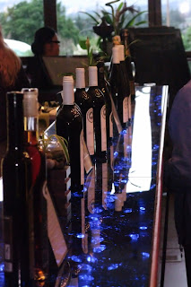
After dinner, on our way out, we checked out their wines they had on display. There was angood sampling of wines, including a couple of ice wines. The ice wines went for $85 and $120 per bottle, so I am coming home without any ice wine. Ha, ha, ha.
 
Bob and Carmen.

Wednesday, June 19, 2013

Western Canadian Rockies (WCR) – Day 9 – Still in Banff

Our goal this morning is to tour the town of Banff. We begin by going to the Banff gondolas and riding up the 7500 feet to the top of Sulphur Mountain. Each gondola holds 4 people, but we were to the top in 8 minutes. As we go up the mountain, we get a good, but hazy of the bow river and surrounding area.


The brochure says that you can see 150 km on a clear day, well this morning it isn’t so clear, but the views are still great.  We can see the whole town of Banff.


Up at the top by the summit building there are three mountain sheep.  They were milling around and even decided to lay down for a little while.  They must be familiar with the noise us humans were making because they did not seem very frightened. 


Two are rams had the classic big horns that wrapped around each side of their head, a classic picture.

While we were walking around the deck around the summit house, it was drizzling a little bit.  Here is a picture of Carmen from the top of Sulphur Mountain looking out towards the mountains.
As we made our way around the summit house, we looked at the gondolas coming up and down the mountain.  We’ll be going back down on one of these is just a little bit.
Although it is drizzling, the clouds seem to be breaking up some.  The sun is coming through in spots and the overall haze seems to be lifting.
We head back down the mountain, as we will soon go to the Bow River falls and the Fairmont Banff Springs.  On the way to the Fairmount, we spot a bull elk and stop to take pictures.
 
Bow Falls (really more like a cascade rapids) runs right in front of the Fairmont hotel.  I found a raft on shore, so I’m ready to go downstream, now that we are below the falls.
As we continue along the road and cross the Bow River, we have a full view of the Fairmont Banff Springs hotel.  It sits on the Bow River just below the falls and is an impressive site with the mountains in the background.
After leaving the overlook for the Fairmont, we come across an elk and her fawn.    She looks as though she was born only a couple of weeks ago.
Carmen thinks the fawn is so cure that I should put a picture of just the new born.
 
We head over to where there are Hoodoos and although the view is okay, we see another golden ground squirrel.
Although we see more elk, the weather seems to improve from earlier.  The mountains seem as they are beginning to get sun even though still covered in some clouds.
We still do not know if the helicopter ride is a go, but we drive out to the helicopter company hoping that they will fly.  When we get there, the sun has just broken through the clouds and has begun to clear and we are a go.  We are in our helicopter and this is the one next to us as they prepare to lift off.
 
We take off and begin our trip which will take us around the mountains for a 30-minute ride.  As we begin, we pass the Three Sisters, a mountain near the helicopter site. 
As we travel around we see mountains  with snow and we also see several mountain lakes like this one. The colors in the photo, taken through the helicopters window, do not seem to capture the true essence of the scene as seen live.
Mountains and lakes truly are the stars of this trip.  Everywhere you look on this trip, the scenes are more fantastic.

The views from the helicopter are unbelievable.  The mountains and valleys clearly show their true splendor from high up in the sky.
In the helicopter, we are able to come close to the mountains and glaciers like this one.  We traversed the glacier close flying from the right to the left and then circled back around for another view.  Simply fantastic views that you would not otherwise see
 
We see more mountains, some still in the clouds, and valleys that are more magnificent one to the next.
Again, as I said before, from the helicopter the views are fantastic, we see mountains, glaciers, mountain lakes, everything you can image.  Pick a photograph as they are all great and it is difficult to determine which one to use.
 
As we head back to the landing pad, we pass this site where some sort of excavation is taking place and steps have been cut out of the hillside.
 
After we land, Carmen and I stop to have someone take our picture in front of the helicopters we just finished flying.   The trip was fantastic, that is only one of the things I can say about the trip.
Our helicopter trip ended, we return to the hotel and end our day.  We continue to see mountains that are simply unbelievable with the sun and snow. 
Tomorrow we leave Banff and begin our trip back to Vancouver.  We will spend the night in Kelowna.  Until then goodnight, Bob and Carmen.

Tuesday, June 18, 2013

Western Canadian Rockies – Day 8 – To Banff

This morning (I'm back on track with the right day, the 17th) we left Jasper and head to Banff driving south along the Icefields Parkway (CA 93).  The weather is perfect this morning; we can see Mt Cavell very clearly with no cloud cover.  Unfortunately, my camera memory card failed later in the day and I lost all of the pictures, so no picture of the clear mountain.  But Carmen did take pictures of several of the mountains, all majestic.
As we head south on CA 93, we made a detour to visit Athabasca Falls.  Carmen was not taking pictures of the falls since she had the wrong lens on her camera, but she did get this picture.

We returned to CA 93 south where the mountains continue to impress us.  The mountains are beautiful, sharp and snow covered.  All I can say is that these mountains are absolutely fantastic.


We pass the forward edge of the Stutfield glacier which has less ice then in years pass because of a calving of the ice.  The left face of the glacier still has some of the ice cascading down.


Again, the mountains we see are so fantastic they have snow covered rocky spires some hundreds of feet thick.

I had asked Art if we would stop at the Tangle Falls just before we reach the Columbia Icefields, he said yes.  So he made a special effort for us to stop while other tour groups drove by.  Thanks to Art and Adrian, I was able to get my picture of Tangle Falls.

 
After a short stay, we left the falls and within a few kilometers, we are at the Columbia Icefield.  To get there we need to hop on board a different bus and ride to where the Ice Explorers will bring us another couple of kilometers.  (Follow the road in this picture and the lateral moraine  about a third of the way up from the bottom and a third of the way from the right, you’ll see a little white line that comes to an end.  That is where we will take the Ice Explorer.)

 
There we hop off of the buss and get into our Ice Explorer, a 3-axel, 6-wheel vehicle and travel along this ice road to get to our terminus which is on the glacier.  The glacier at that location is about 1000 feet thick.
When we arrive at our destination, we have a good view of the three-tiered ice fall coming down from the Columbia Icefield to help build the Athabasca Glacier.

 
It is hard to imagine but Carmen and I are standing on 1000 feet of ice and in front of the ice falls.  The temperature was not too cold, though it was getting colder the longer we stayed outside.

 
There was a brook of glacier water running along the glacier.  It disappeared, either in a hole or behind a ridge, but I did not go looking for it.  Everyone was drinking water from the slush and it did not look so clean.  Too bad, had I gone to this brook, I could have had thousand year old water to drink.
From our location on the glacier and looking back to the road and visitors center, you can see how flat it looks.  It is deceiving that we are on a thousand feet of ice.
Here are the Ice Explorers that we used to travel along the glacier.  Ours is the middle one. You can see the size of the vehicles by the people standing next to them. So to give you an example, the tires are about 5 feet high and 3 ¼ feet wide. 
Here is the A-A Glacier, so named because it is between Mt Athabasca (3442 meters high - on the left) and Mt Andromeda (3450 meters - on right).
So we begin to head back and this is the ice road we used to travel to out onto the glacier.  We are now returning the same way and you can clearly see the steepness of the climb back up to the busses.  That is an 18% grade we will go up.  The bus on the bottom of the hill is going through the water run off from the glacier.
As we reached the top while waiting for the bus, I saw these people hiking the glacier.  The told us that you could hike the glacier, even climb the three-tiered ice falls and up onto the Columbia Icefield, but you should have a guide and tied by ropes to each other.  This is to help if you fall through a crevasse.  These people do not look like they have any ropes.  Good luck,
After a quick lunch and before we leave for Banff, we get one last glimpse of the Athabasca Glacier.  Look at how tiny the Ice Explorers look!  So you know we traveled some distance to get to the top of the glacier.
We continue on our way and look at the mountain scenery we have.  You can see the snow up on the ridge leaning over the edge.
As we were driving along, there was a sort of traffic jam up ahead.  When we got there and drove by slowly, we see that there was a mountain goat causing all of the commotion.  We went by just as slowly as everyone else.
We see waterfalls coming down off of the mountains from the glacial run off.  Here is one of the typical waterfalls.
We pass mountains that are fantastic to view; it is difficult not to take a picture, from big flat top mountains.
To pyramid mountains, some in the clouds, some creating their own clouds, like this one and every shape in between.
And still other mountains with glaciers.  If it was not for Adrian driving the bus, I don’t think I would have made Banff at a reasonable time.
Before Banff, we make a quick stop to view Peyto Lake.  What a fantastic view.  The color of the water in the lake was aqua and I hope the color comes through in the photo.  I think they should rename the lake to Wolf Lake because of the wolf profile the lake creates – just my opinion.
While at the lake overlook, we spotted a golden mantled ground squirrel. 
After photographing many more fantastic mountains than I can count, we turn down the road to go to Lake Louise.  Here is the lake looking to Victoria Glacier at the end of the lake. 
Here is Fairmont Chateau Lake Louise from across Lake Louise.
A Clarks Nutcracker sat and posed in all its glory.
And finally have I mentioned how fantastic the mountain views are?  We make it to Banff our final destination for the night and the views are still fantastic.  Tomorrow more time in Banff, until the Bob and Carmen.